


Report, Verify, and Respond
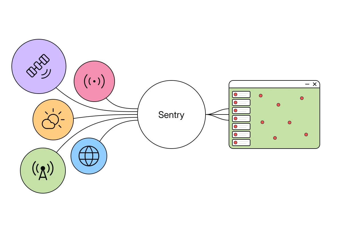
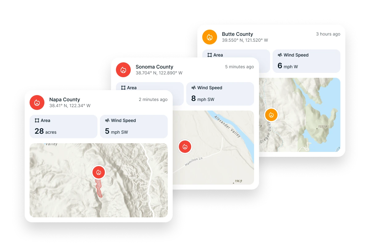
Sentry continuously monitors satellite imagery, web feeds, emergency alerting networks, sensor data, and dispatch systems to aggregate and surface relevant emergency updates in real time. It filters and validates notifications before distributing them to emergency managers, dispatchers, and field personnel through the Ladris Core platform.
Detection
Identify Early Signals
Processes multiple live data sources — from satellite feeds to environmental sensors — to quickly identify new ignitions or emerging events.
Verification
Validate and Filter Notifications
Cross-references input data to filter relevant notifications before they reach operators, reducing false positives and noise.
Distribution
Deliver Actionable Intelligence
Filtered notifications reach agency dashboards, mobile devices, and field units with contextual data, empowering teams to act faster and coordinate effectively.
Key Advantages
From First Signal to Coordinated Response
Multi-Source Intelligence in One Stream
By monitoring satellite feeds, sensors, and communications together, Sentry provides a unified view of developing conditions — giving teams continuous awareness of high-priority events across their jurisdiction without switching between systems.
Early Awareness, Faster Response
Sentry accelerates the identification and verification of emerging incidents, allowing agencies to act within minutes of event onset. Automated notifications reduce reliance on manual reporting and shorten the time between event occurrence and operational response.
Built for Operational Integration
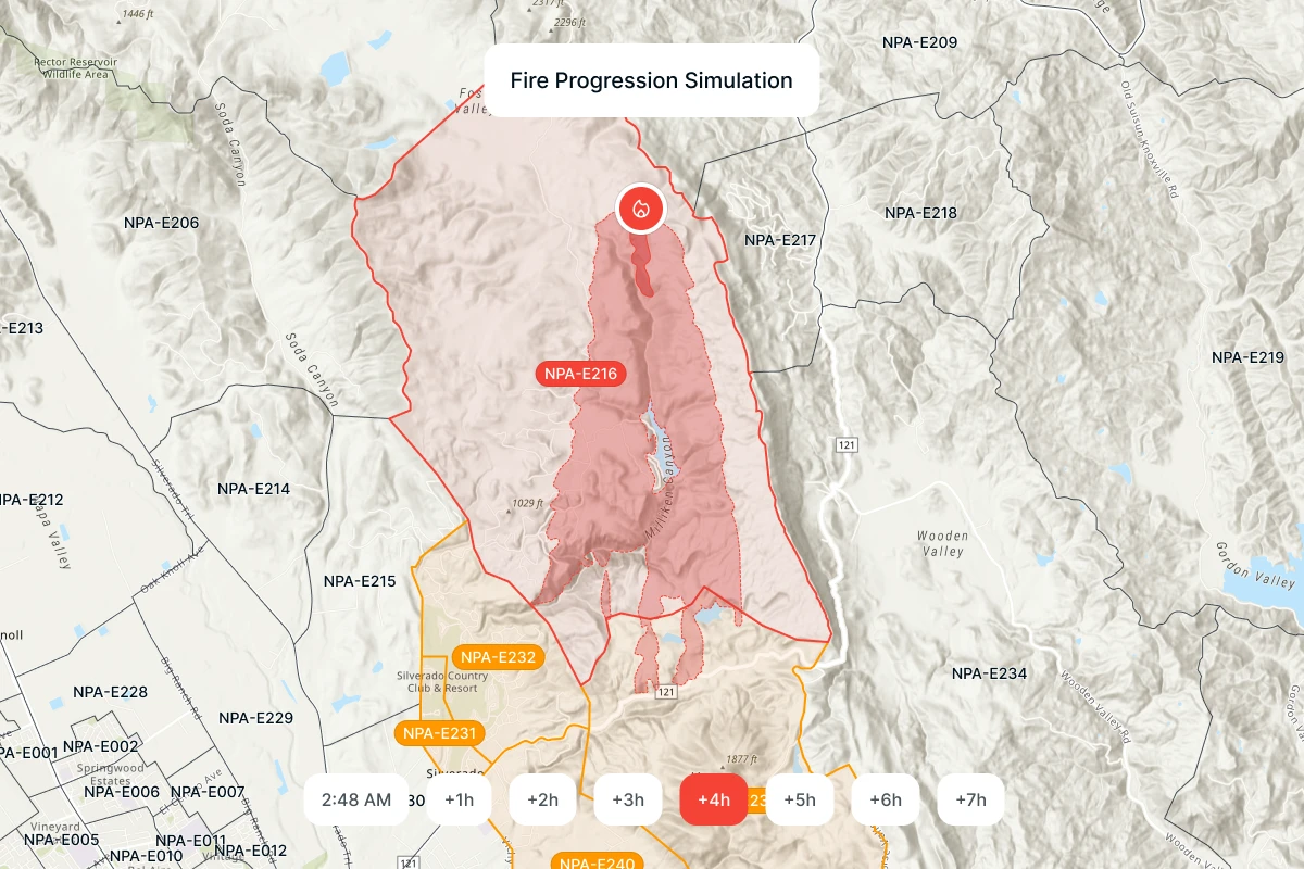
Every notification is delivered with operational context — forecasted impacts, location details, and response considerations — through the Core platform. Decision-makers can move immediately from detection to action using connected planning tools.


Built for Teams That Respond in Real Time
Sentry supports organizations responsible for early warning, incident detection, and real-time response coordination. It enables agencies to act on verified intelligence and maintain a shared operational picture across departments and jurisdictions.

Reduced Response Time
Sentry closes the gap between event occurrence and identification, helping agencies mobilize resources before incidents escalate.
Enhanced Situational Awareness
Delivers unified situational awareness by combining satellite, sensor, and communication inputs into a single, continuously updated picture.
Scalable Integration
Connects with the Ladris Core platform, linking notifications to forecasts, evacuation modeling, fire and flood tools, and field personnel.
© 2026 Ladris Technologies, Inc. All Rights Reserved.


