


Wildfire Modeling and Simulation
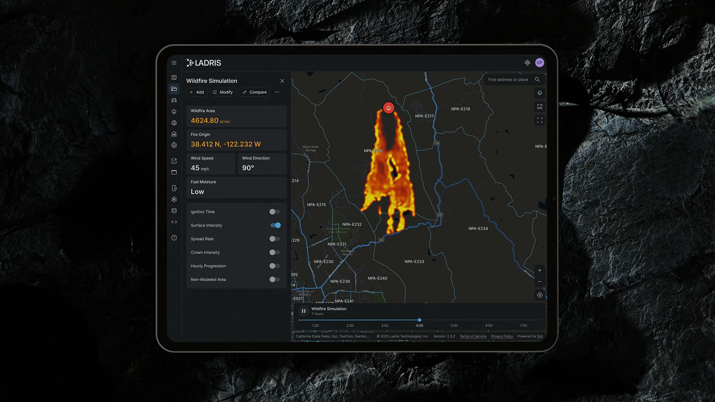
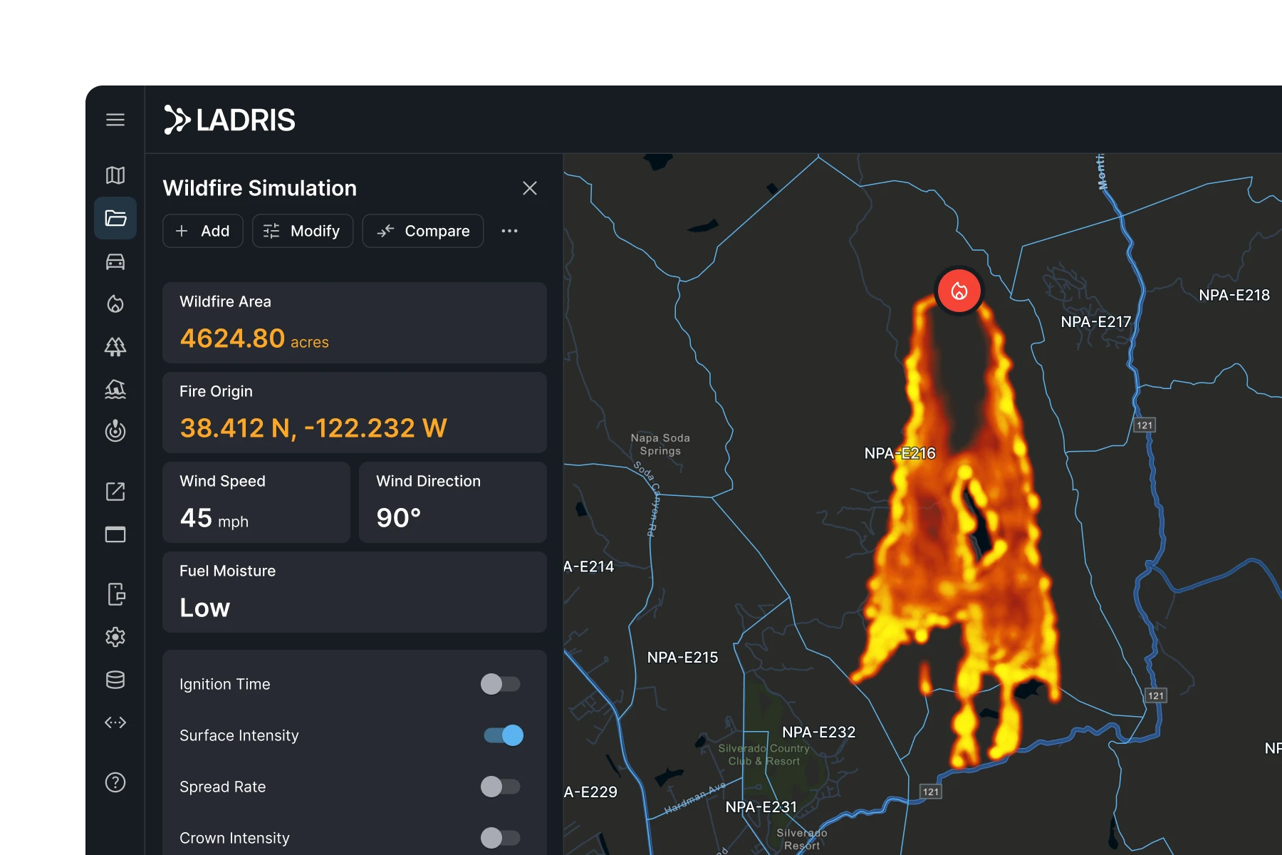
Ladris Fire equips emergency teams with predictive tools to simulate fire behavior. Built on fire spread models that resolve interactions among wind, terrain, and fuels, Fire delivers high-speed simulations of fire growth and community impact.
Speed
Simulation Results in Seconds
Simulations run in seconds and update automatically as conditions change — no manual setup or calibration required.
Granular Modeling
High Fidelity Fire Behavior
Resolves interactions among wind, terrain, and fuels to produce detailed fire spread projections.
Decision Support
Timed for Critical Decisions
Gives emergency managers the fire behavior data they need to determine suppression and response priorities.
Key Advantages
Built for Every Stage of Wildfire Management
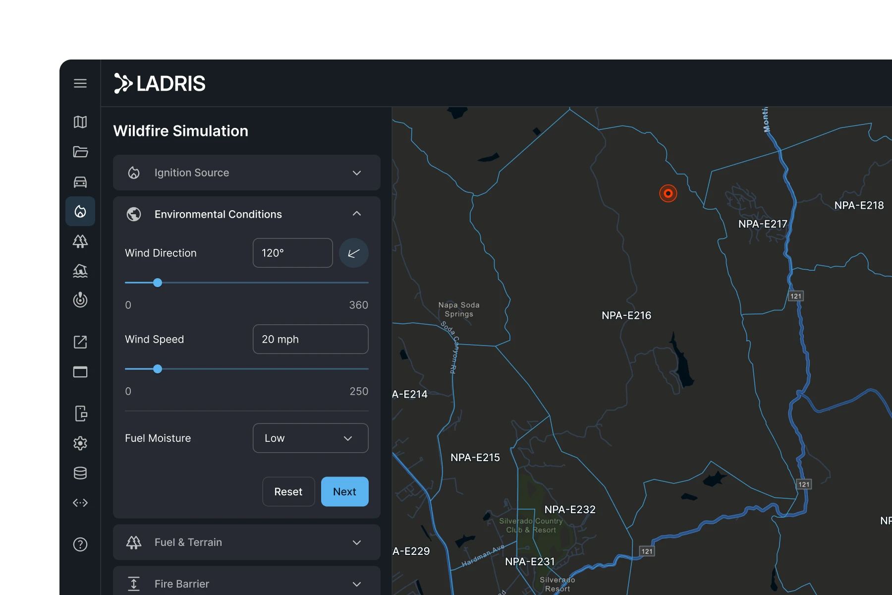
Fire Spread Modeling in Live Conditions
Ladris Fire generates predictive fire spread maps using current weather, terrain, and vegetation data. Simulations run in seconds and automatically adjust as new information becomes available, helping emergency teams anticipate growth patterns and prepare suppression strategies.
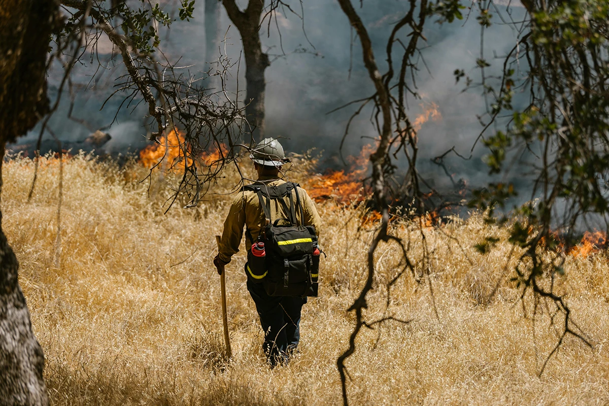
Tactical Planning for Suppression and Containment
Evaluate terrain-driven fire behavior and identify where mitigation actions — dozer lines, fuel breaks, retardant drops — will be most effective. These insights shape vegetation management strategies and guide operational responses in both active incidents and long-term planning.
Pre-Season Risk Assessment
Map high-risk areas ahead of fire season using fuel data, terrain, and prevailing wind patterns — giving your team a clear picture of where the greatest threats exist before conditions develop.


From First Spark to Suppression Strategy
Ladris Fire is designed for professionals managing wildfire response, community protection, and mitigation planning. It helps agencies build and refine their Wildfire Protection Plan, conduct pre-season fire risk assessments, and improve coordination during active wildfire events.

Know When to Evacuate
Predict fire spread and identify the ideal window for issuing evacuation orders.
Allocate Resources Strategically
Focus fire response on critical assets and infrastructure with real-time insights.
Plan Ahead of Fire Season
Map high-risk areas and validate suppression strategies before conditions develop.
© 2026 Ladris Technologies, Inc. All Rights Reserved.


