


Unified Emergency Intelligence
One System for Every Emergency Management Decision

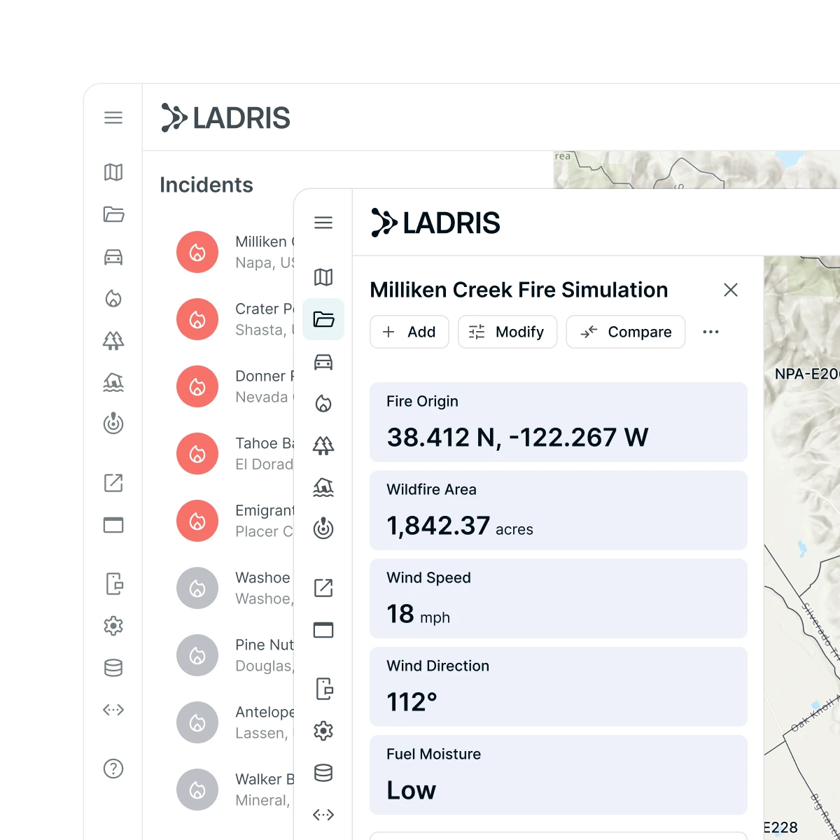

See the Whole Risk Landscape
Core aggregates thousands of live and historical data sources — from sensors and satellite feeds to infrastructure and demographic data — creating a single, continuously updated operational picture your whole team can work from.
Move from Detection to Action in Seconds
Automated hazard detection triggers scenario modeling instantly, enabling disaster and evacuation analysis and response coordination without delay.
Make Decisions That Withstand Scrutiny
Scenario-based analytics surface population risk, mobility constraints, and infrastructure vulnerability — delivering defensible insights across preparedness, mitigation, response, and recovery.
The Core Platform
The Engine Behind Every Decision
.webp)

All Ladris Products. One Unified Platform.

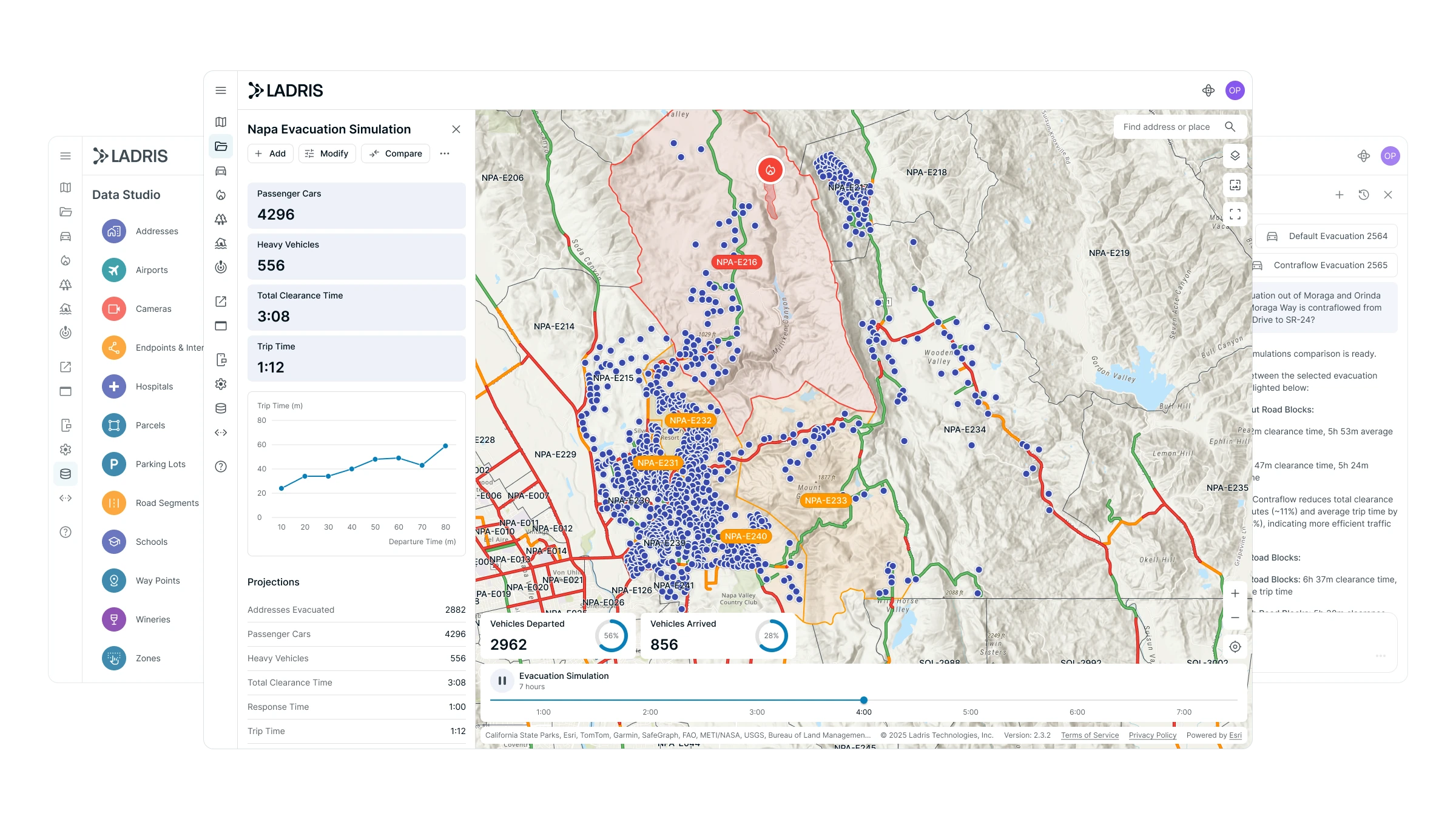
Evac
Evacuate any community safely


Fire
Predict wildfire spread in seconds

Fuels
Simulate fuel treatment projects

Flood
Forecast near-term flood events

Impact
Measure impact of response strategies

Sentry
Monitor validated, real-time disaster information

OEZ
Free
Build and manage custom zones

Sentinel
Free
Access personalized risk insights and alerts
Built with Purpose
Designed for Strategic Leadership

Balance Growth and Safety
Measure development tradeoffs and guide smarter land use and resilience planning.
Accelerate Emergency Response
Use real-time insights and scenario modeling to act faster when it matters most.
Protect Vulnerable Communities
Identify at-risk populations and simulate evacuations to ensure safe, timely movement.
Detect Threats Earlier
Leverage early warning data to anticipate wildfire, flooding, and emerging hazards.
Plan for Long-Term Resilience
Build data-driven mitigation strategies aligned with state and federal goals.
Unite Teams Around One Picture
Enable multi-agency collaboration through a shared, real-time operational view.

Customer Stories
Learn How Ladris is Helping Build a Safer Future


© 2026 Ladris Technologies, Inc. All Rights Reserved.


