


Risk Intelligence Built for Emergency Managers
Many agencies have only pieces of the picture — static models and outdated evacuation plans. Ladris creates the entire picture in real time, providing a continuously updated risk operating system your whole team can work from.
1
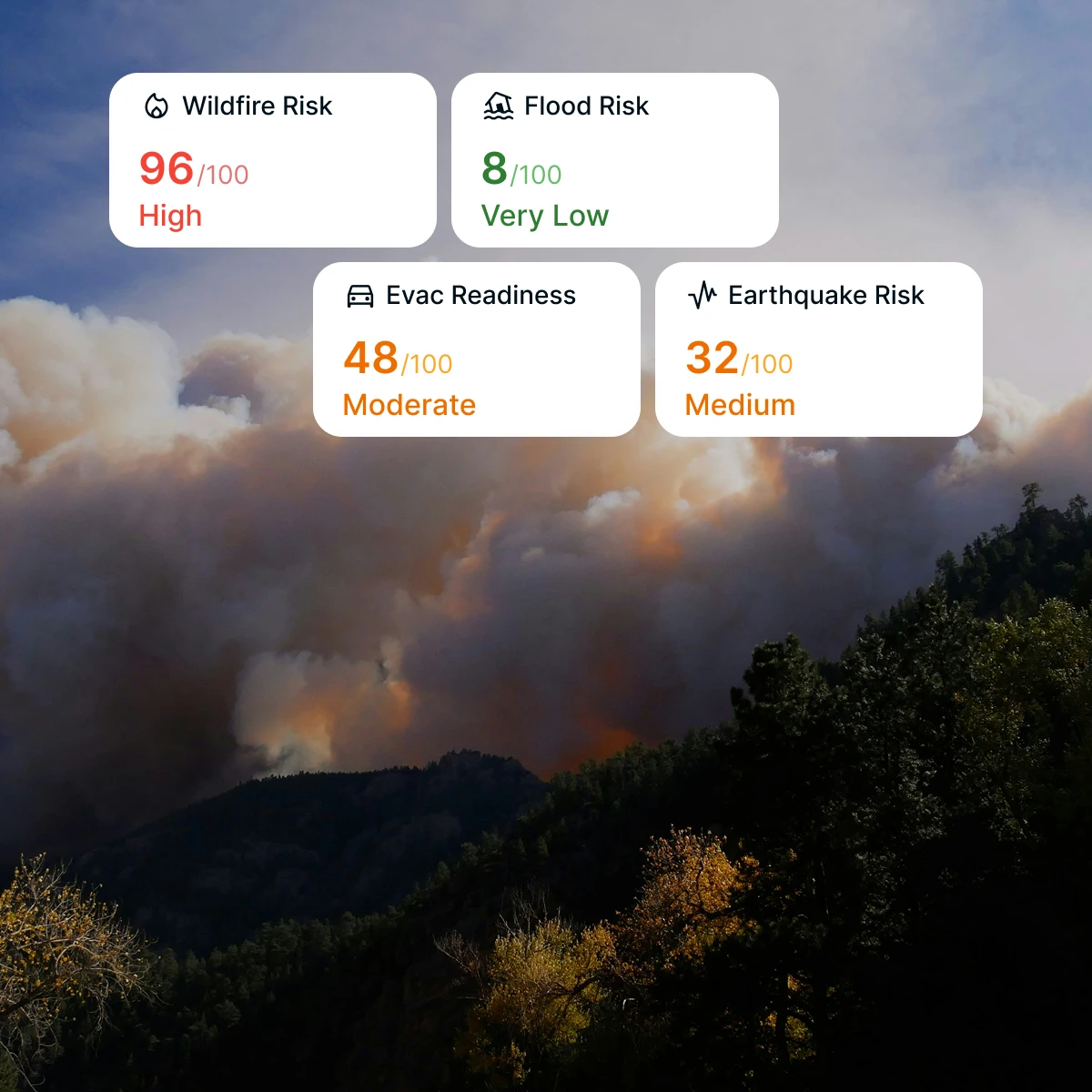
See Every Threat Across Your Jurisdiction
Natural disasters and hazardous exposure don't obey boundaries. Ladris integrates fire behavior modeling, flood forecasting, fuel load data, and real-time sensor feeds into one unified view, so you always know what you're facing and where your community is at risk.
2
Quantify Risk in Terms Leadership Understands
Translating technical hazard data into decisions your elected officials and community leaders will act on is incredibly time consuming. Ladris surfaces risk as impact — lives, structures, and infrastructure exposed — so you can quickly build a clear and defensible case.
3
Build the Foundation for Every Grant Application
Federal mitigation funding rewards jurisdictions that can demonstrate documented, data-backed risk. Ladris gives you the hazard assessments, exposure analysis, and community vulnerability data you need to compete for funding and track progress over time.
4
Prioritize Resource Deployment Based on Maximum Impact
You can't mitigate every risk at once. Ladris helps you model scenarios, compare outcomes, and rank interventions by the lives and assets they protect — ensuring your time and funding goes where it matters most.
© 2026 Ladris Technologies, Inc. All Rights Reserved.


