


Paid Plan Features
Paid plans build on the Open Plan foundation, adding more data, modeling capabilities, and human support to help your agency operate with confidence.
Advanced Modeling Capabilities
Move beyond default simulations. Paid plans unlock configurable parameters, live data feeds, scenario comparison, and increasingly sophisticated modeling tools.
Custom Data Feeds
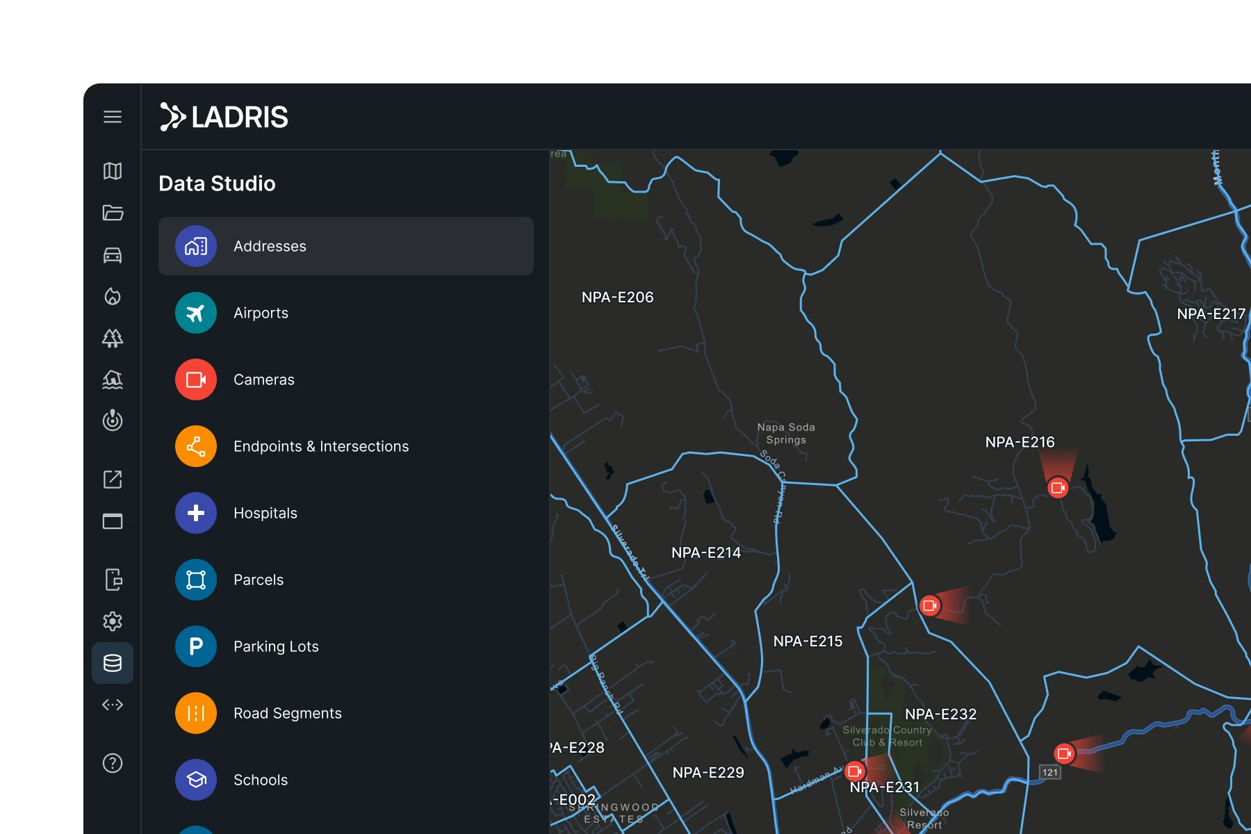
Every paid tier adds proprietary, licensed, and locally collected data sources — from commercial routing and parcel boundaries to historic incident patterns and locally calibrated environmental inputs — on top of the open data foundation, leading to more precise outputs across every product.

Expert Support at Every Stage
Every paid plan includes dedicated support scoped to your tier, with access to Forward Ops — Ladris' team of field-tested emergency management professionals available to work directly alongside your agency in planning, training, and active response.
A Platform That Grows With You
All plans are designed to scale. Start with Essential to improve operational readiness, move to Professional for advanced scenario capabilities, or deploy Enterprise across multiple agencies. Your data, configurations, and workflows carry forward at every step.
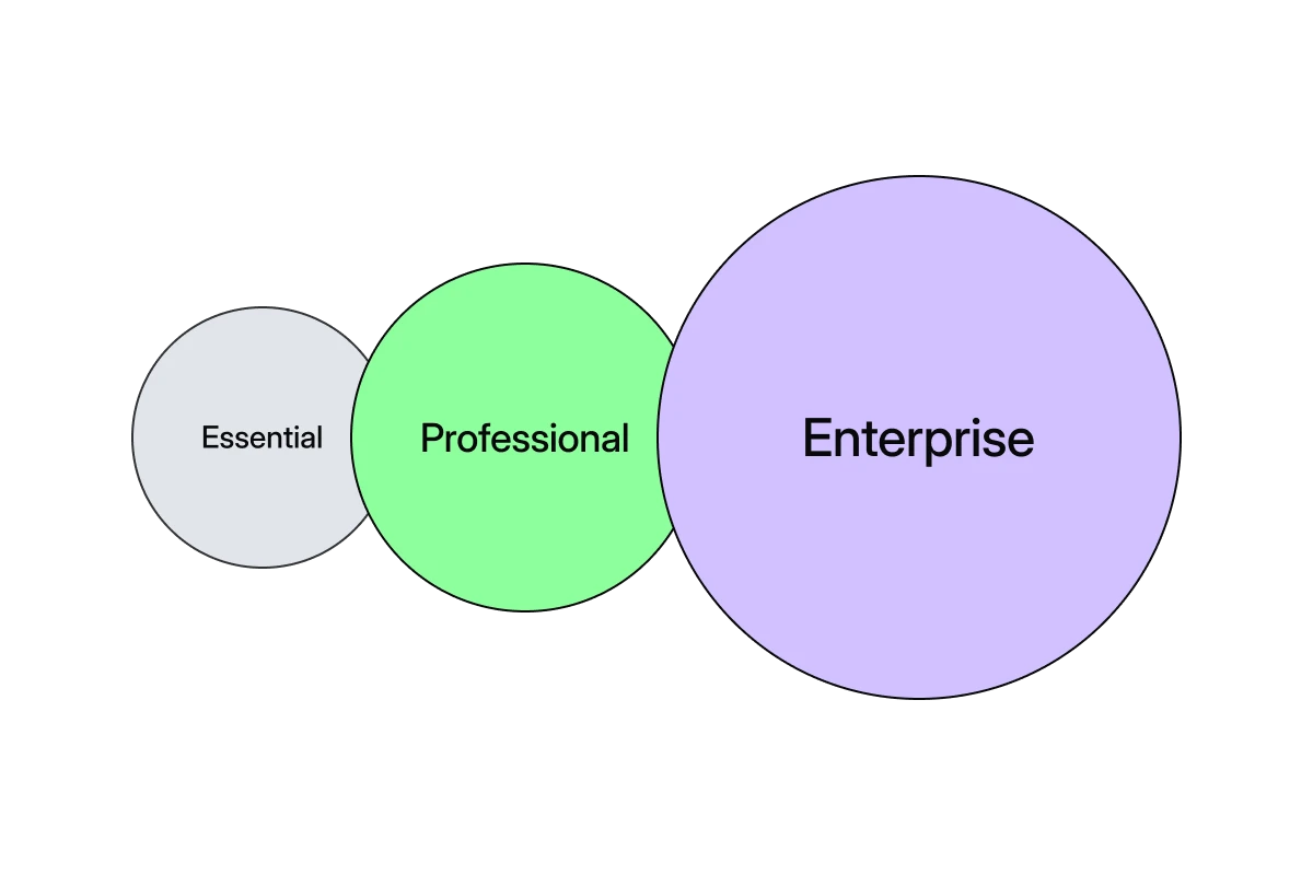
Choose the Plan That Fits Your Program
Essential
For smaller jurisdictions working to build out their emergency management foundation with evacuation and disaster modeling and guided support.
What's Included

Live traffic feeds and configurable evacuation parameters
Real-time incident monitoring across all hazard types
All-hazards resident notifications via Sentinel App
Flood forecasting with USGS gauge integration
Wildfire spread modeling with live wind data
Guided onboarding, template workflows, and dedicated support
Professional
For agencies looking to enhance their daily workflows and response strategies with advanced evacuation and disaster simulations built with consistent support.
What's Included
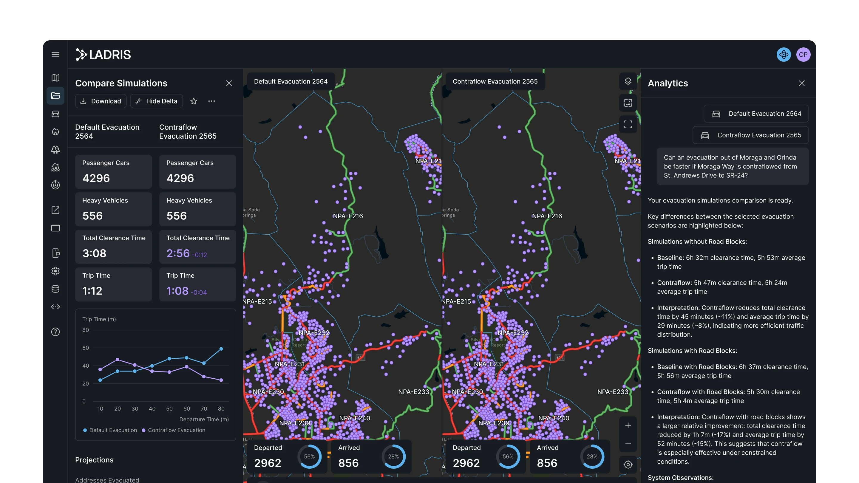
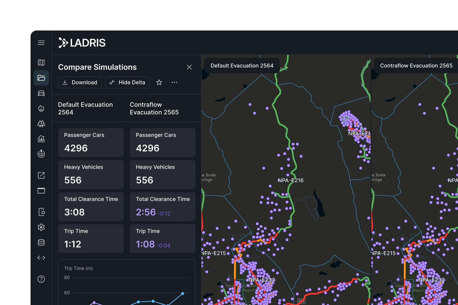
Advanced evacuation scenarios including phased evacuations and contraflow
Side-by-side simulation comparison and scenario analysis
Live environmental modeling with custom fuel and flood datasets
Custom notification templates for resident communications
Analytics — conversational interface for simulations and reports
Dedicated CSM, analyst support, live training, and quarterly reviews
Enterprise
For jurisdictions looking for a multi-agency deployment of advanced modeling tools with unlimited proprietary data integration and large-scale, immediate support.
What's Included
Shared data environments across multiple agencies and jurisdictions
Continuous monitoring with automated scenario triggering
Impact module for enterprise-wide risk assessment and visualization
Expert human review of all data inputs and model assumptions
Forward Ops — field-deployed emergency management experts embedded in your program
Dedicated ops team, 24/7 coverage, and 1-hour SLA


© 2026 Ladris Technologies, Inc. All Rights Reserved.


