


Assess Risk. Model Treatments. Defend Decisions.
Fuels gives wildfire planners and land stewards a high-resolution view of where risk is greatest and what will help mitigate it. Model burn probability, fireline intensity, and asset exposure across your landscape, then test treatment strategies side by side to measure their real-world impact before any physical work begins.
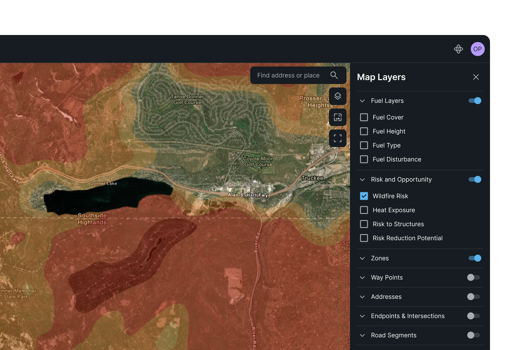
Risk Mapping
Landscape-Scale Risk Assessment
Models burn probability, fireline intensity, and asset exposure across your entire landscape, identifying where fire poses the greatest threat.
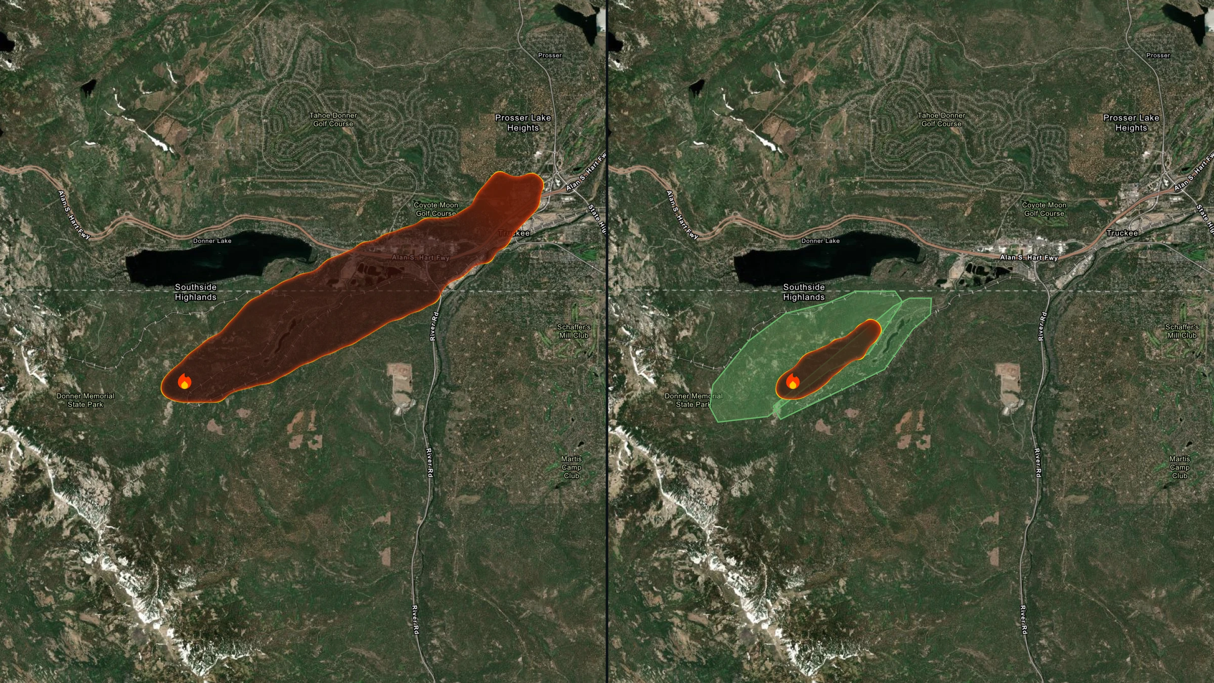
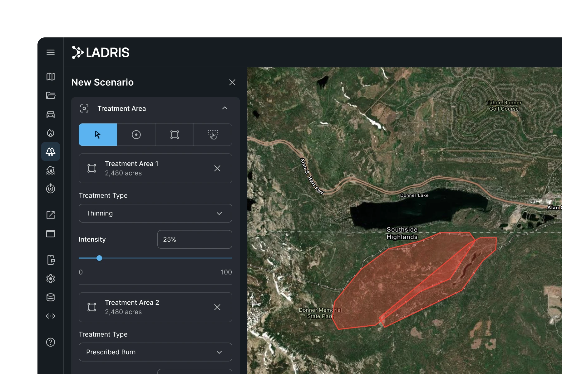
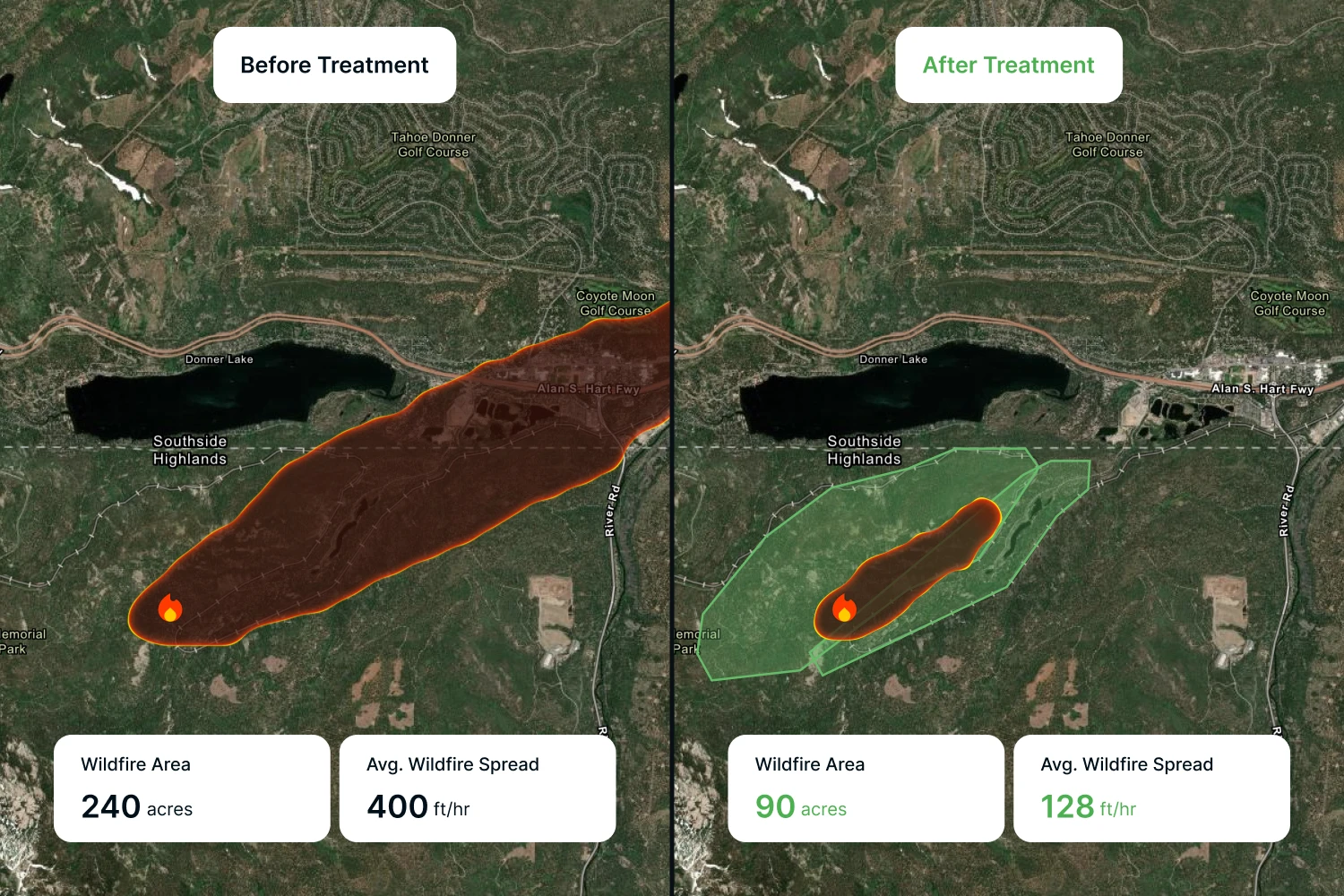
Scenario Comparison
Treatment Scenario Comparison
Define and compare treatment strategies side by side, measuring their impact on fire behavior and risk reduction before any work begins.
Atmospheric Modeling
Physics-Based Fire Simulation
Resolves terrain effects, wind shifts, plume dynamics, and crown fire transitions within a high-resolution, physically accurate model.
Key Advantages
Make Every Mitigation Dollar Count
Prioritize Where Mitigation Has the Most Impact
Not all fuel treatments deliver equal results. Fuels helps planners identify where interventions will reduce fire intensity and spread the most, so limited budgets can cover the areas that matter most.
Identify At-Risk Roads and Infrastructure
Fuels models roadside heat intensity and terrain-driven fire behavior to identify where evacuation routes may become unsafe or critical infrastructure is exposed.
Build the Case for Funding and Investment
Side-by-side scenario comparisons give agencies the documentation they need to communicate mitigation value, support grant applications, and build long-term wildfire resilience programs that hold up to scrutiny.

Built for Fire Prevention Managers and Land Use Planners
Fuels supports professionals at utilities and governments responsible for reducing wildfire risk and protecting lives, property, and infrastructure. Built for those who need to plan ahead, allocate resources strategically, and defend decisions with data.

Identify Effective Mitigation
Evaluate which fuel treatments positively change outcomes and prioritize where to act.
Plan Safer Evacuations
Identify roads where fire behavior could create fatal conditions without intervention.
Protect Critical Infrastructure
Use side-by-side modeling to evaluate and defend fuel treatment decisions near high-value assets.
© 2026 Ladris Technologies, Inc. All Rights Reserved.


