


One Data Layer. Every Product. Full Control.
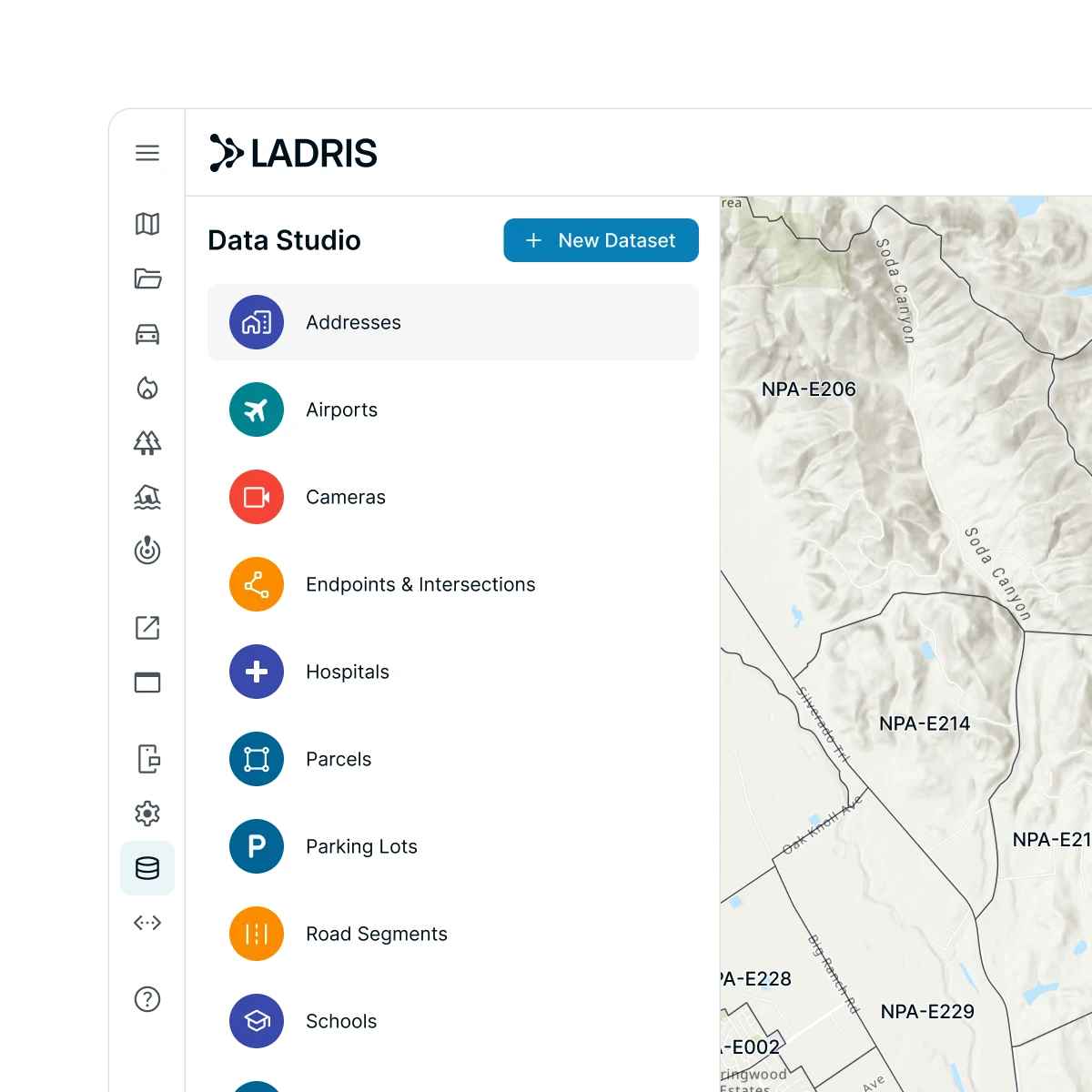
Every product on the Ladris platform is only as good as the data behind it. Data Studio is where that data lives — aggregating geospatial, environmental, infrastructure, and community datasets into a single, continuously updated environment.
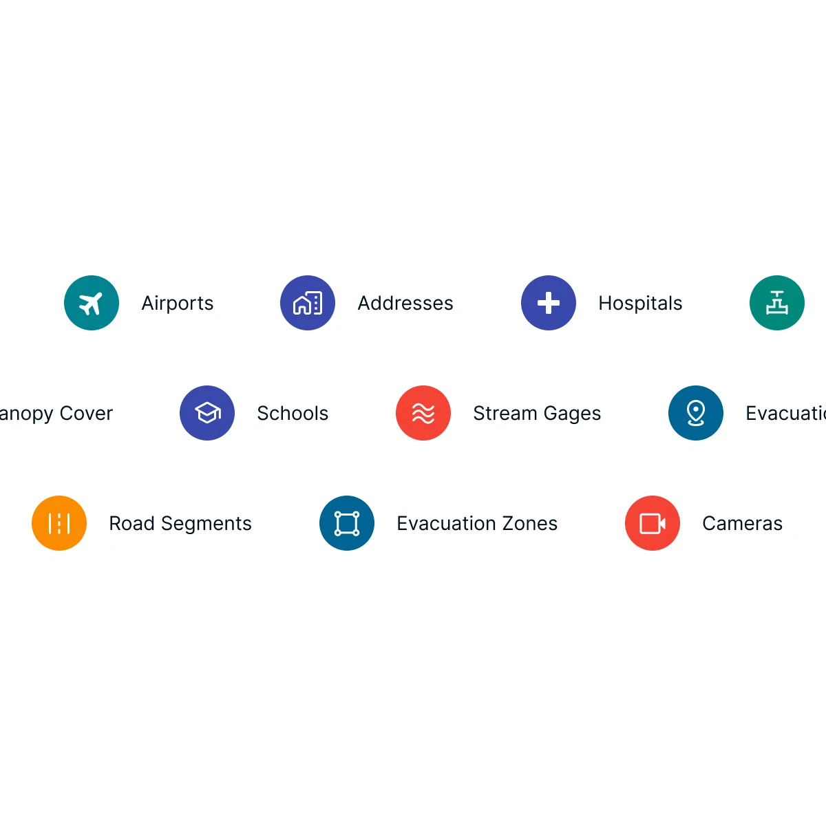
Your Jurisdiction, in Full Detail
Parcels, road networks, critical infrastructure, hospitals, schools, and community assets, all assembled into a complete, continuously updated picture of your jurisdiction.
Ground Every Model in Real Conditions
Environmental inputs — stream gauges, fuel moisture levels, vegetation classifications, terrain, and weather feeds — determine how accurately the platform models live conditions and what comes next.
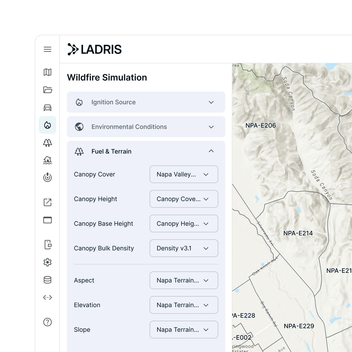
Enrich the Platform With Your Own Data
Ensure every product reflects the conditions your team works with by uploading proprietary datasets, locally collected data, and agency-specific information to replace or layer on top of default inputs.
Open Data
Every Plan Starts With Open Data.
Every Ladris plan includes access to a curated library of publicly available hazard, terrain, and community datasets — ready to use from day one. Data Studio builds on this foundation, letting agencies layer in custom data as their program grows.

Hazard and Environmental Data
USGS stream gauges, NWS weather feeds, LANDFIRE fuel layers, and public topographic data — the environmental foundation for flood forecasting, fire modeling, and hazard assessment.
Community and Infrastructure Data
Census population data, public road networks, and community asset information — the geospatial foundation for evacuation planning, impact assessment, and risk communication.
Ready to Enrich
Open Data is the starting point. As your program matures, Data Studio lets you layer in proprietary, licensed, and locally collected data, progressively improving the accuracy of every product on the platform.
© 2026 Ladris Technologies, Inc. All Rights Reserved.


