When a disaster is unfolding, Ladris provides a real-time operating picture for your whole team — so every decision is grounded in the current data rather than instinct alone.
Real-Time Intelligence for Every Stage of Response
During an active event, every minute matters — yet most agencies are arduously piecing together information from disconnected and outdated systems. Ladris puts a unified, continuously updated operating picture in front of your team to enable prompt and informed decisions from the first alert to the final all-clear.
1
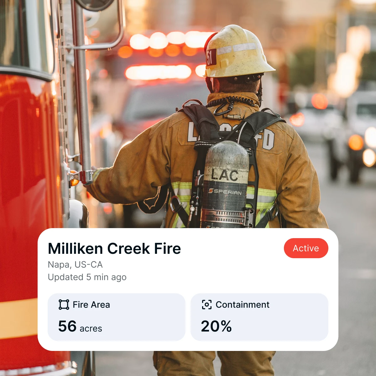
Know the What, Where, and When of Every Incident
Ladris integrates real-time fire detection, flood sensors, weather feeds, and field reports into one continuously updating view, so your team can track how a threat develops from start to finish.
2
Issue Evacuation Orders at the Right Moment
Ladris directly connects fire spread modeling to evacuation zone data, giving you the clearance time estimates and route conditions you need to issue precise orders at the right time.
3
Coordinate Across Agencies Without Difficulty
When multiple agencies are responding to the same event, a fragmented picture leads to fragmented action. Ladris creates a common operating picture so that every team — fire, law enforcement, emergency management — is aligned and resources go where they're needed most.
4
Forecast Incident Impact in Advance
Ladris projects where a threat is heading and what assets are in its path. Understand which communities and infrastructure face the greatest exposure so you can prepare response and resource deployment ahead of the event.
What Customers Say
"Ladris was a dependable and trusted partner in our effort to build a data-driven evacuation plan.”
Andrew Notbohm
Director, Pikes Peak Regional Office of Emergency Management