


Data-Driven Evacuation Planning and Response Intelligence
Evac brings together population data, traffic patterns, and road conditions to simulate and optimize emergency evacuations — for both long-term planning and active disasters. Built with domain experts and validated by the scientific research community and local officials, Evac delivers proven results in real-world scenarios.
Credibility
Validated by Experts in the Field
Built with independent domain experts and tested by the emergency managers and first responders who depend on it.
Multi-Hazard
Works Across Every Hazard Type
Handles wildfire, flood, and all-hazard scenarios, so your team is prepared no matter what threat is developing.
Real-World Complexity
Built for the Field
Models phased movements, contraflow operations, and road closures to reflect what actually happens on the ground.
Key Advantages
From Planning to Active Response
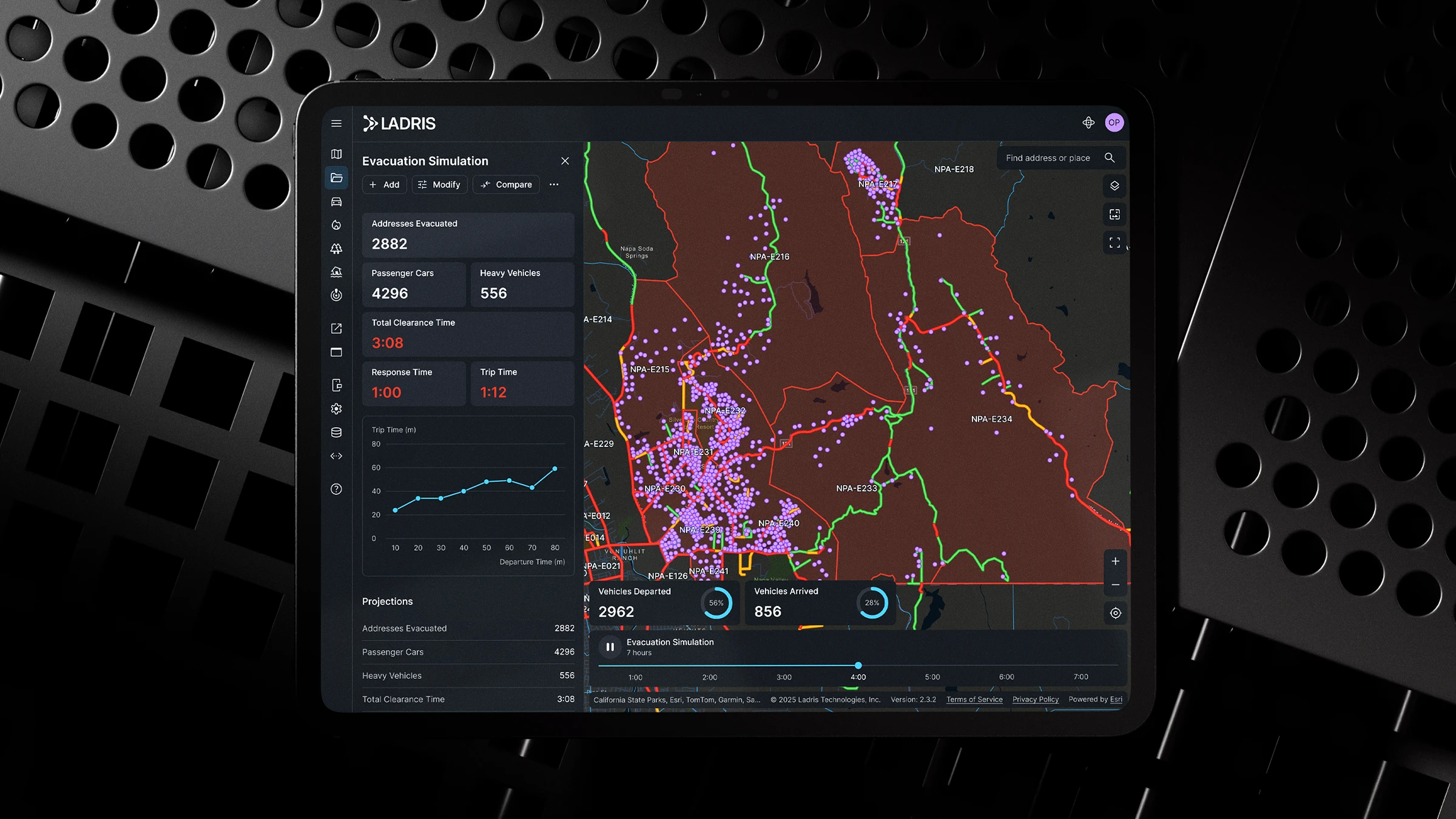
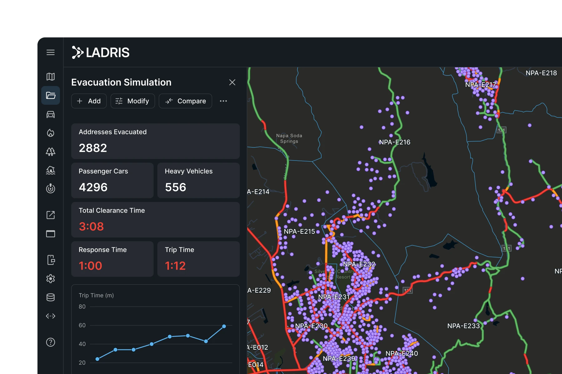
Real-Time Evacuation Simulation
Evac supports dynamic evacuation modeling using live or scenario-based traffic and infrastructure data. Agencies can test staging strategies and evaluate how different constraints affect evacuation performance and timing during active or planned events.
Risk-Informed Planning and Forecasting
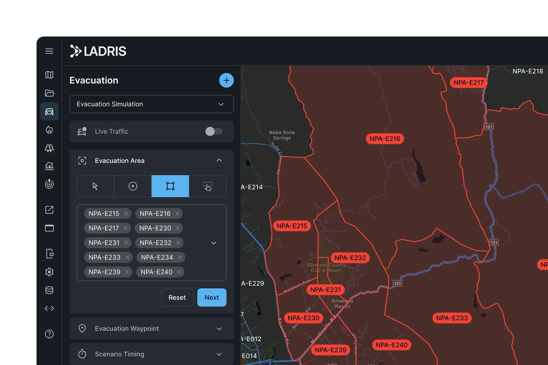
The platform enables long-term evacuation planning based on historical hazards, demographic risk factors, and local transportation systems. Emergency managers can build and validate evacuation strategies for a variety of hazard types and threat levels.
Optimized Infrastructure Investments
Evac helps agencies identify and prioritize infrastructure improvements that directly impact evacuation effectiveness. Teams can determine where upgrades such as signal timing changes, lane expansions, or vegetation clearance would reduce evacuation times and improve safety outcomes.


Built for Local Governments and Emergency Teams
Evac empowers agencies to improve performance in every phase of emergency management, from preparedness and mitigation to real-time response and recovery.

Estimate Evacuation Timelines
Predict how evacuations will unfold under different hazard, population, and infrastructure scenarios.
Prioritize High-Risk Communities
Identify and plan for vulnerable populations with limited mobility or close proximity to hazards.
Assess Development Impacts
Evaluate how future infrastructure, land use planning, or zoning changes will affect evacuation routes and feasibility.
Determine Optimal Timing
Use live data and predictive models to choose the most effective moment to initiate evacuations.
Create and Manage Zones
Flexibly define and manage evacuation zones — or operate seamlessly without predefined zones.
Stress-Test Plans and Tactics
Practice evacuations before they happen, so teams can act with confidence and coordination during the real event.
© 2026 Ladris Technologies, Inc. All Rights Reserved.


