Most emergency plans are based on outdated assumptions and limited testing. Ladris helps you build dynamic plans that reflect live conditions — plans that can change in real time and hold up during a disaster.
1
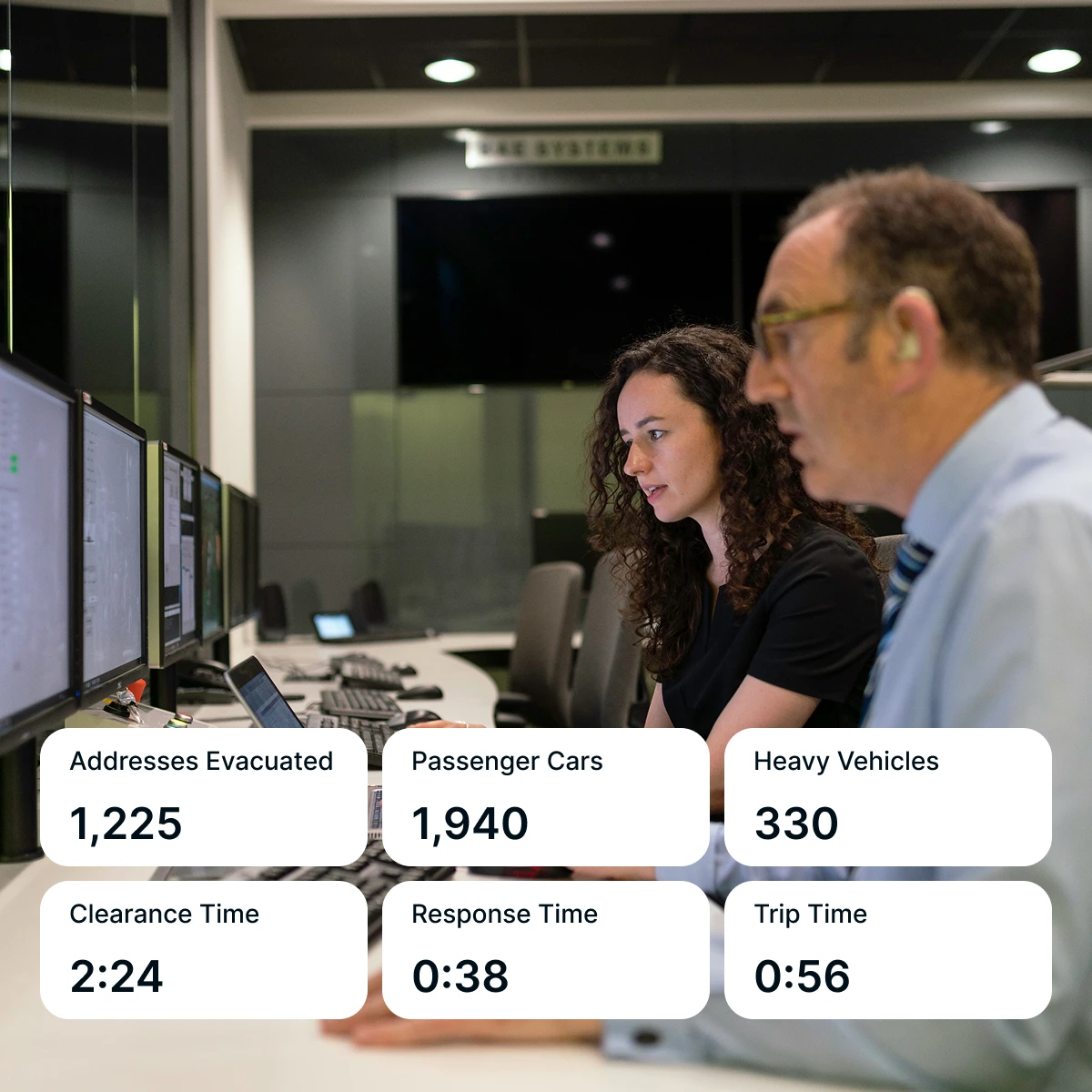
Create Defensible Evacuation Plans
Model zone- and polygon-based evacuations with clearance times and route capacity using real terrain, traffic, and population data. Identify bottlenecks before they impede movement, and generate the documentation needed to support your plans with officials and the public.
2
Anticipate How Hazards Will Unfold
Model wildfire spread, flood impact forecasts, and hazard interaction with your community's roads, population centers, and critical infrastructure — and build your plans on these data-driven predictions.
3
Test Your Plans Before You Need Them
Run what-if scenarios against real conditions — road closures, infrastructure failures, peak traffic periods, and concurrent hazards. See exactly where your plan holds and where it needs work before the next activation.
4
Keep Plans Current as Conditions Change
Ladris continuously updates your planning environment with new hazard data, population changes, and infrastructure information, ensuring your plans are always up to date.
What Customers Say
"Ladris was a dependable and trusted partner in our effort to build a data-driven evacuation plan.”
Andrew Notbohm
Director, Pikes Peak Regional Office of Emergency Management