


Prescriptive Fuel Treatment Modeling for Risk Reduction
FuelsRx enables wildfire planners and land stewards to assess fuel strategies and prioritize areas where interventions are most effective.
Powered by the first-ever commercially available atmospheric fire model and the Ladris Core platform, FuelsRx simulates the weather created by fire behavior at a resolution that shows where fire suppression may fail, where heat could block evacuations, and how that risk can be improved with specific mitigation projects.
Coupled Atmospheric-Fire Simulation
FuelsRx is derived from a high-resolution fire–atmosphere modeling framework originally developed by Dr. Janice Coen as part of her scientific research. It simulates wildfire behavior by resolving interactions among wind, slope, fuels, and atmospheric conditions, generating large volumes of physically based output.
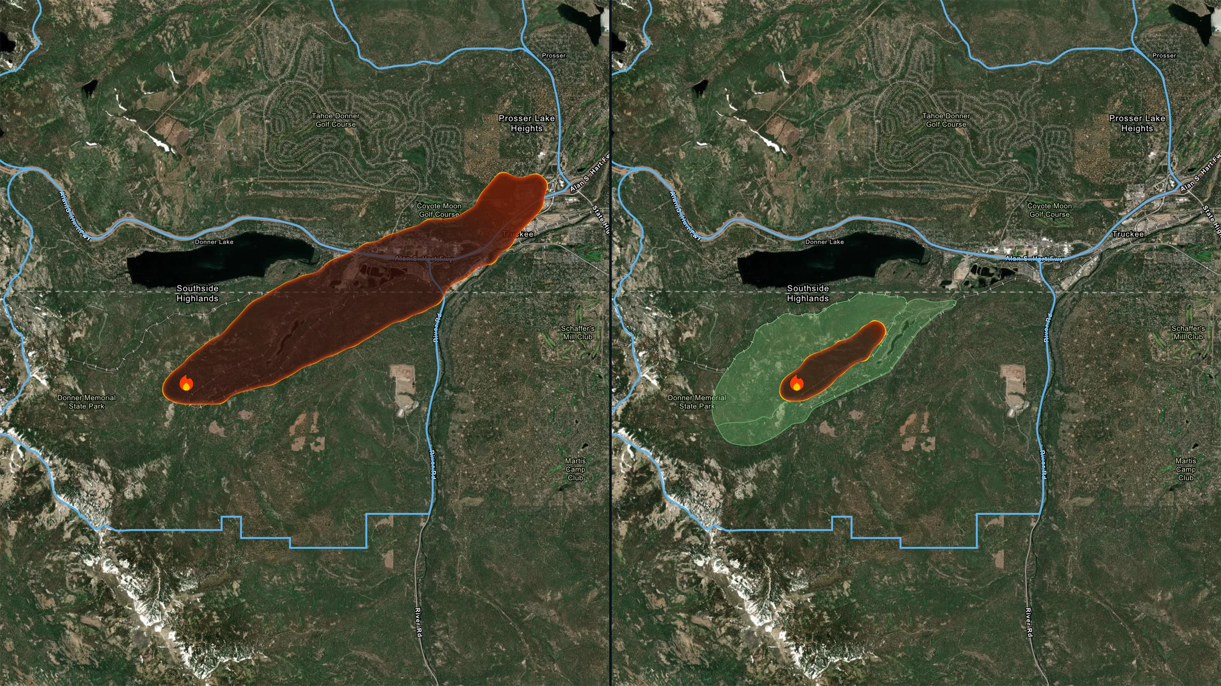
Fuel Treatment Scenario Comparison
Define and compare different fuel treatment strategies, such as thinning, clearing, or prescribed burns, under the same environmental conditions. FuelsRx models how changes in fuel type, structure, and load affect fire spread, intensity, and exposure, giving planners a clear picture of where fuel interventions will reduce risk.


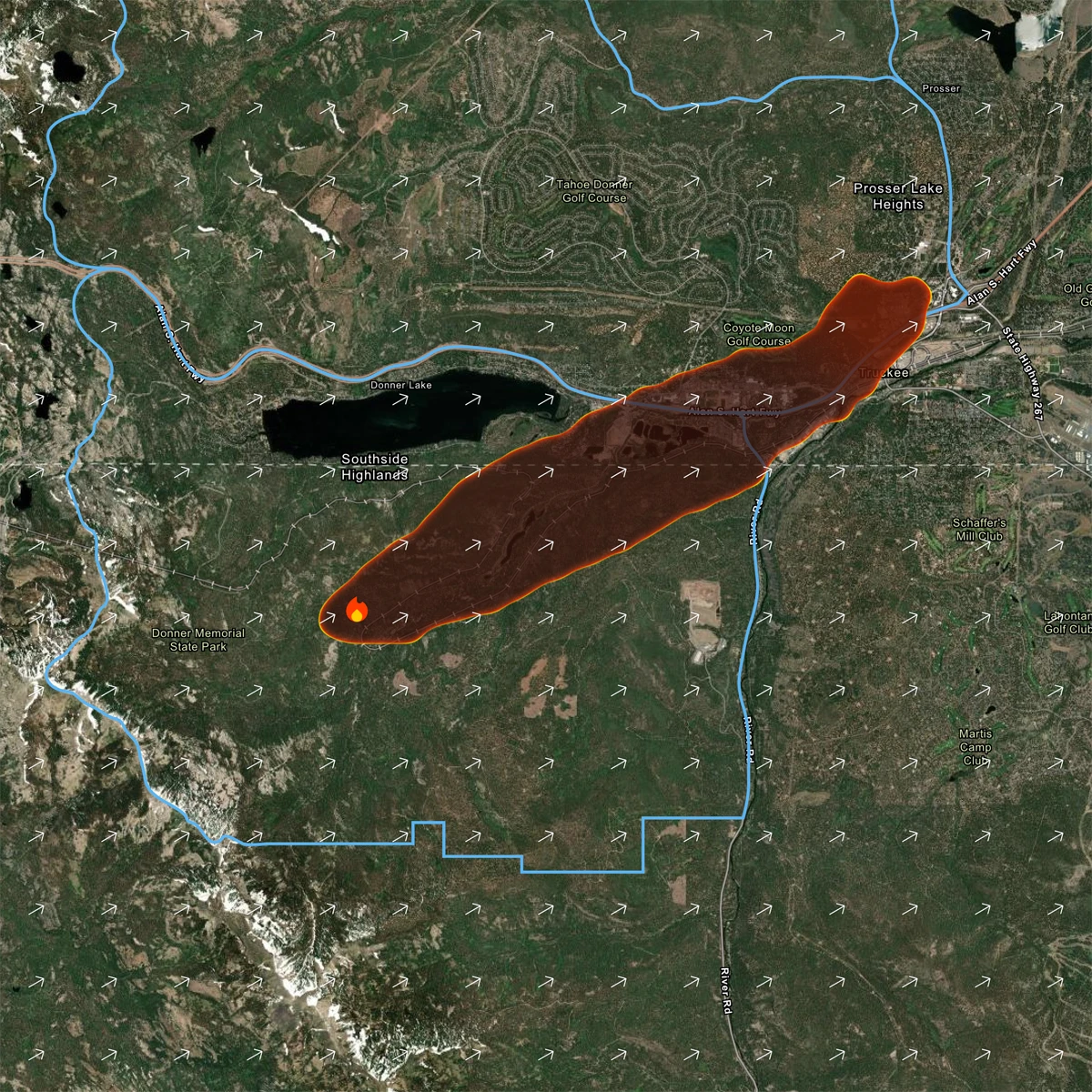
Evacuation Route Heat Exposure Analysis
FuelsRx models roadside heat intensity and terrain-driven fire behavior to identify where evacuation routes may become unsafe or infrastructure is at risk. These insights support pre-fire planning, helping agencies strengthen evacuation timing, route selection, and protection of critical assets.
Built with Purpose
Built for Fire Prevention Managers and Land Use Planners
FuelsRx supports professionals responsible for reducing wildfire risk and protecting lives, property, and infrastructure. Prescriptive interpretation of data by best-in-class domain experts improves confidence in outcomes and helps generate support for mitigation projects.
.svg)
Identify Effective Mitigation
Evaluate which fuel treatments actually change outcomes and prioritize where to act.

Plan Safer Evacuations
Identify roads where fire behavior will create fatal conditions without intervention.

Protect Critical Infrastructure
Use side-by-side modeling to evaluate and defend fuel treatment decisions.

Core
Part of a Unified Disaster Intelligence Platform
FuelsRx runs on the Ladris Core platform and is delivered through Forward Deployed Operations, ensuring that wildfire planning is consistent with other emergency operations and local hazard planning efforts and built on a common source of data that can be updated as projects continue on the ground. Use real forecasts, real terrain, and real missions to shape defensible outcomes.
No One Should Die in a Disaster
.svg)


